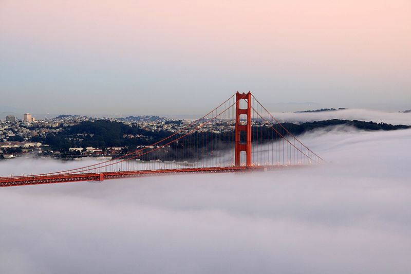
Figure 1 – A stunning image of San Francisco’s Golden Gate Bridge by Brocken Inaglory 2009. From the Wikimedia Commons under creative commons license.
I am grateful to reader Marilyn for send a link to a fantastic collection of photographs in “The Atlantic” celebrating the seventy-fifth anniversary of the completion of the Golden Gate Bridge. Is it ironic that the source of this celebration of a historic West Coast event would be “The Atlantic?” Hmm!
Nevertheless, the event is well worth celebrating and, of course, both San Francisco’s Golden Gate and the bridge named after it have figured significantly in Western Photography. I thought that I would post here Figure 1 – a stunning sunset photograph taken in 2009 showing the bridge enshrouded in fog and Figure 2 – a 1910 image from the National Park Service showing the view from the San Francisco side across the strait to Marin County before the bridge was built.
Missing from “The Atlantic’s” gallery of images are two brilliant iconic images my Ansel Adams. The first is from 1932 and shows the Golden Gate before the construction of the bridge. The second is from 1953 and shows the Golden Gate spanned by its namesake bridge. These photographs remind us of the natural beauty of the San Francisco bay, the engineered beauty of the Golden Gate Bridge, and finally they stand as stunning examples of Ansel Adams’ photography.
The Golden Gate, of course, was just that. It was the Gateway for the forty-niners to gain entrance to San Francisco harbor and the California gold fields. I am reminded that one of the finest American daguerreotypes from 1850 or 1851 shows the San Francisco harbor literally filled with merchant ships. The image is shown in Figure 3 and pictures Yerba Buena Cove with Yerba Buena Island in the background.
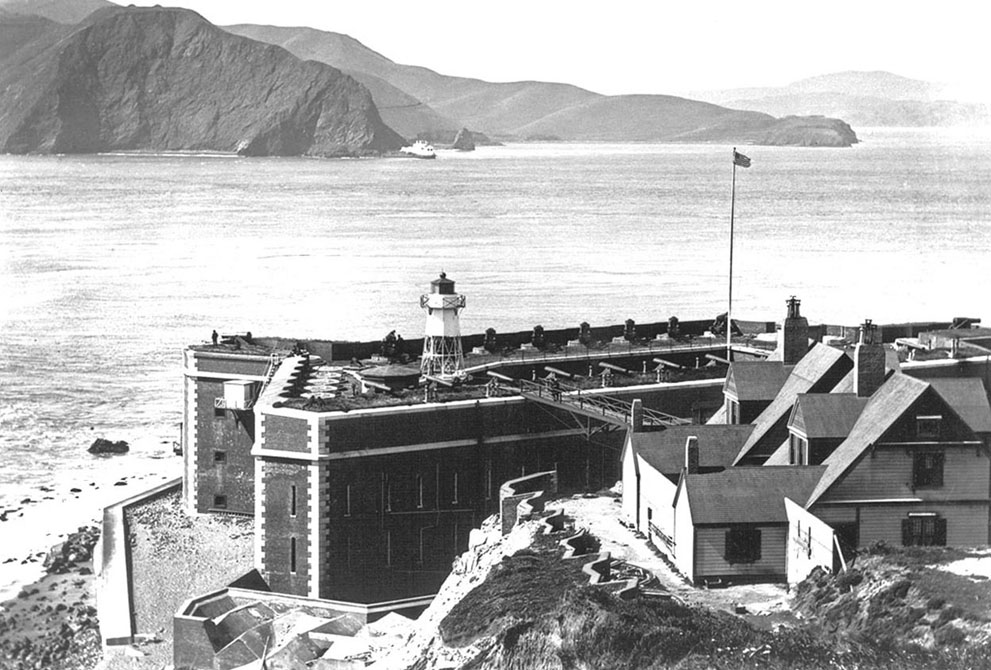
Figure 2 – San Francisco’s Golden Gate in 1910 before the bridge was built, showing Fort Point and looking across the strait towards Marin County. Image from the US National Park Service and in the public domain.
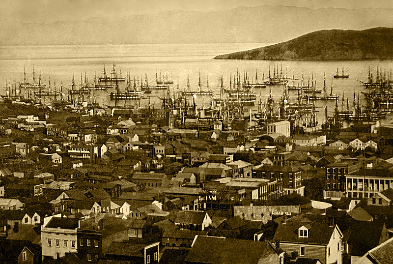
Figure 3 – Daguerreotype of San Francisco harbor (Yerba Buena Cove), in 1850 or 1851, with Yerba Buena Island in the background. Daguerreotype. From the Wikimedia Commons and the LOC in the public domain.